Payment protectionDetails
- Revisions within the package are free.
- If you do not respond within 3 days of delivery, the work is accepted automatically.
The money is reserved when you pay and released only once you accept the work.
Example result
Illustrations for a children’s book
3 illustrations
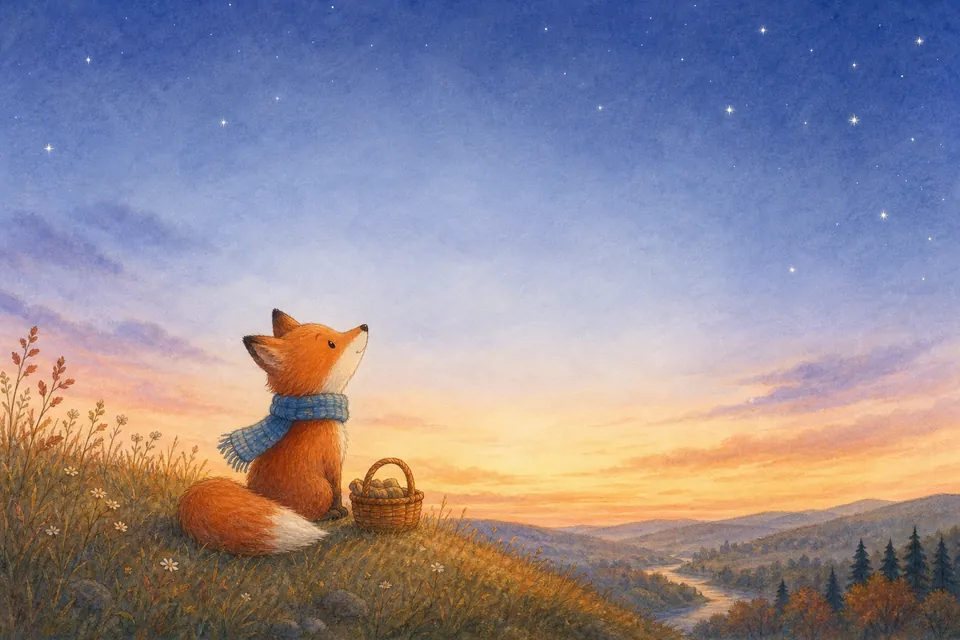

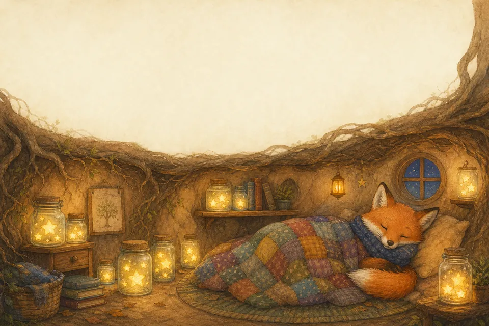
Client: an author preparing the picture book “The Fox Who Collected Stars”. Task: three spreads in soft watercolor, the same fox in every scene, space at the top for the text.
The client and all details are made up.
About this service
A trail map has to show at a glance which loop is easy, where the viewpoint is and where the path climbs, so visitors pick the right route at the trailhead or on your website. We draw an illustrated bird's-eye map of your park, resort or hiking area with trails in distinct colors, relief, lakes, huts and viewpoints, in a hand-drawn style that suits a welcome board or a guide. It is a picture, not surveyed cartography: trail names, distances and the legend are added by you on top.
What is included
- What you getA landscape trail map illustration as a PNG file, with colored routes and landmarks and free space for your legend. Vector, layered and print-shop files are not included.
- Colored routesEach trail easy to tell apart
- Relief and waterHills, valleys, lakes and rivers
- Trail landmarksHuts, bridges, viewpoints, parking
- Room for a legendYou add names and distances
- Season moodSummer greens or snowy slopes
How it works
- 1Route listYou mark the trails and stops
- 2DrawingWe draw the area from above
- 3LabelsYou add names and the legend
What we need from you
A link to the area on an online map, the trails you want shown and their colors, key stops such as huts, springs or viewpoints, and the season and style.
We will ask you:
- Which trails should the map show?
- What landmarks lie along the way?
- Summer, winter or all-season look?
- Where will the map be used?
Compare packages
| Packages | Basic1 trail map$15 | Standard3 map illustrations$29 | Premium6 map illustrations$55 |
|---|---|---|---|
| Deadline | 1 day | 2 days | 4 days |
| Revisions | 1 | 2 | 3 |
| Illustrations | 1 | 3 | 6 |
| Format | PNG | PNG | PNG |
| Order Basic | Order Standard | Order Premium |
Payment protection
You pay when you order, but the money is released only for accepted work.
- Fixed priceThe package price does not change after you pay.
- The money is reservedWhen you pay, the amount is only reserved. It is released to the service once you accept the work.
- Checked before deliveryEvery result goes through a quality check before it reaches you, and you see it on the order page before accepting it.
- Free revisionsAsk for changes within your brief as many times as the package allows.
- Acceptance after 3 daysIf within 3 days of delivery you neither accept the work nor ask for changes, it is accepted automatically. If you write in the order chat after delivery, the order waits; once we answer, we may start the 3 days again and will say so in the chat.
- Redo or a full refundIf the result does not match your brief and the revisions did not fix it, or the work takes more than twice its deadline, write in the order chat: we will redo the work or refund the payment in full.
Questions and answers
Will the map be accurate enough to navigate by?
It follows your description and the layout of the area, but it is an illustration, not a surveyed map. Keep exact distances and elevations in the legend you add.
Can you write the trail names on the map?
We can put one short title, such as the park's name. Trail names and numbers come out more reliably when you add them in any editor.
Is it suitable for a large outdoor board?
The PNG is fine for screens, guides and small prints. For a large board, check with your print shop whether the size is enough; print-ready files with bleed are not included.